From Empirical to Scientific
From Empirical to Scientific
The problem of slope instability, which includes falling blocks and landslides, can cause material and human damage, particularly to roads, motorways, and railways.
The problem of slope instability, which includes falling blocks and landslides, can cause material and human damage, particularly to roads, motorways, and railways.
The problem of slope instability, which includes falling blocks and landslides, can cause material and human damage, particularly to roads, motorways, and railways.


Our Solution
Evolving from empirical to scientific knowledge.
To make this possible, our vision is based on 5 main pillars:
Evolving from empirical to scientific knowledge.
To make this possible, our vision is based on 5 main pillars:
Precision 3D modelling
Precision 3D modelling
Precision 3D modelling
Precision 3D modelling
Based on a LiDAR survey and the capture of images using a drone or airplane, our solution produces a three-dimensional model with an accuracy of <50 mm.
For more demanding use cases we work with a sub-centimetre definition, thus obtaining a reliable representation of the real world.
Based on a LiDAR survey and the capture of images using a drone or airplane, our solution produces a three-dimensional model with an accuracy of <50 mm.
For more demanding use cases we work with a sub-centimetre definition, thus obtaining a reliable representation of the real world.
Scale processing
Scale processing
Scale processing
Scale processing
Our technology was designed and engineered from the very beginning to respond to the processing of several km2 of area under analysis.
Considerable effort has gone into the construction and development of optimised models, making it possible to obtain economically viable computing and a remarkable speed in processing information of such magnitude.
Visualisation and interaction with the system
Visualisation and interaction with the system
Visualisation and interaction with the system
Visualisation and interaction with the system
Fluid access to the large-scale model
Availability on any computer without the need to install any piece of software and its maintenance
An ergonomic and modern "User Experience", thus reducing the learning curve
Fluid access to the large-scale model
Availability on any computer without the need to install any piece of software and its maintenance
An ergonomic and modern "User Experience", thus reducing the learning curve
Stability analysis
Stability analysis
Stability analysis
Stability analysis
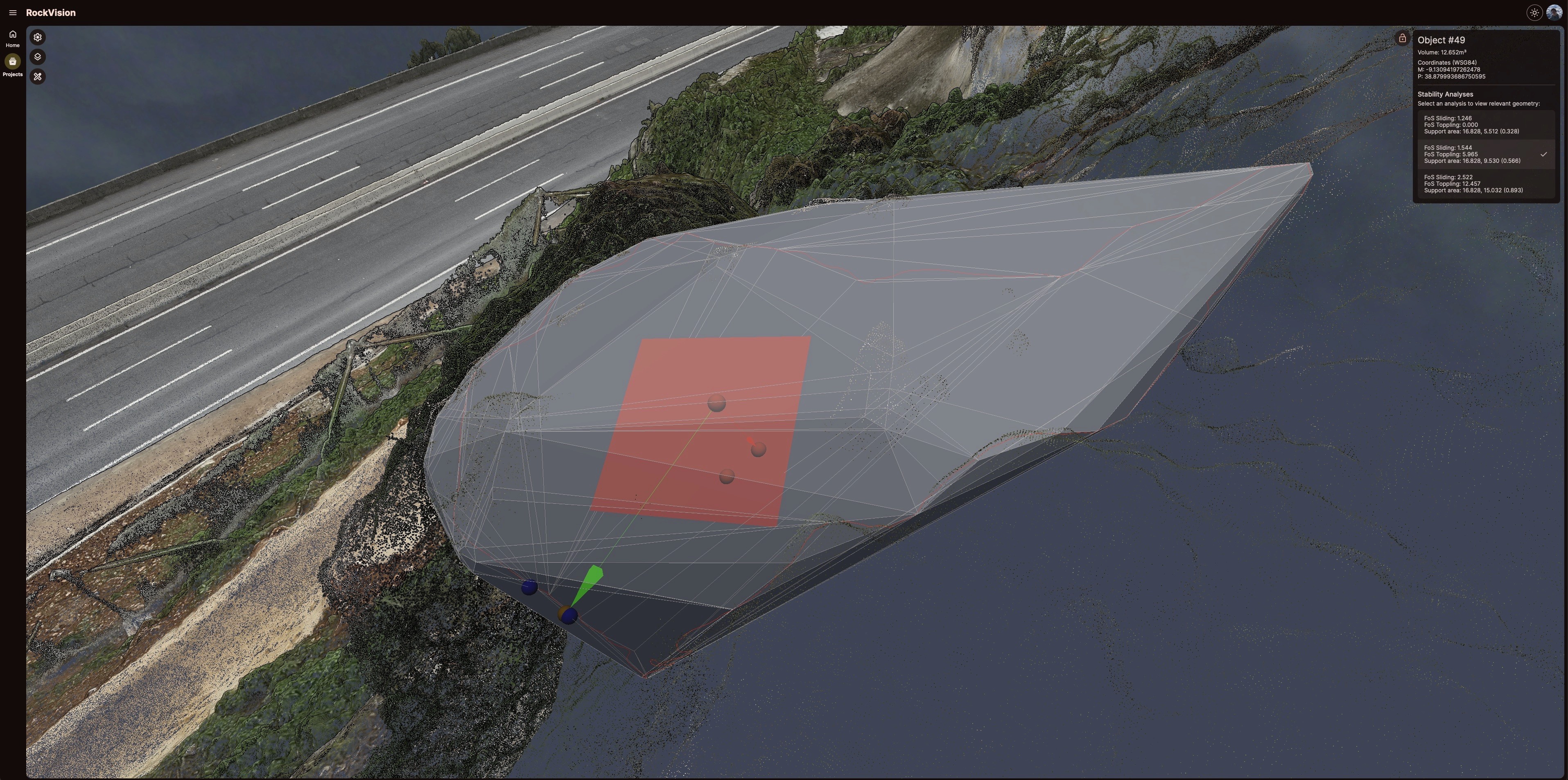
The analysis involves the calculation of 3 sequential steps:
1) Sliding safety factor (FoS Sliding)
2) Toppling safety factor (FoS Toppling)
3) Support area
The analysis involves the calculation of 3 sequential steps:
1) Sliding safety factor (FoS Sliding)
2) Toppling safety factor (FoS Toppling)
3) Support area
The analysis involves the calculation of 3 sequential steps:
1) Sliding safety factor (FoS Sliding)
2) Toppling safety factor (FoS Toppling)
3) Support area


Powering decision-making
Powering decision-making
Powering decision-making
Powering decision-making
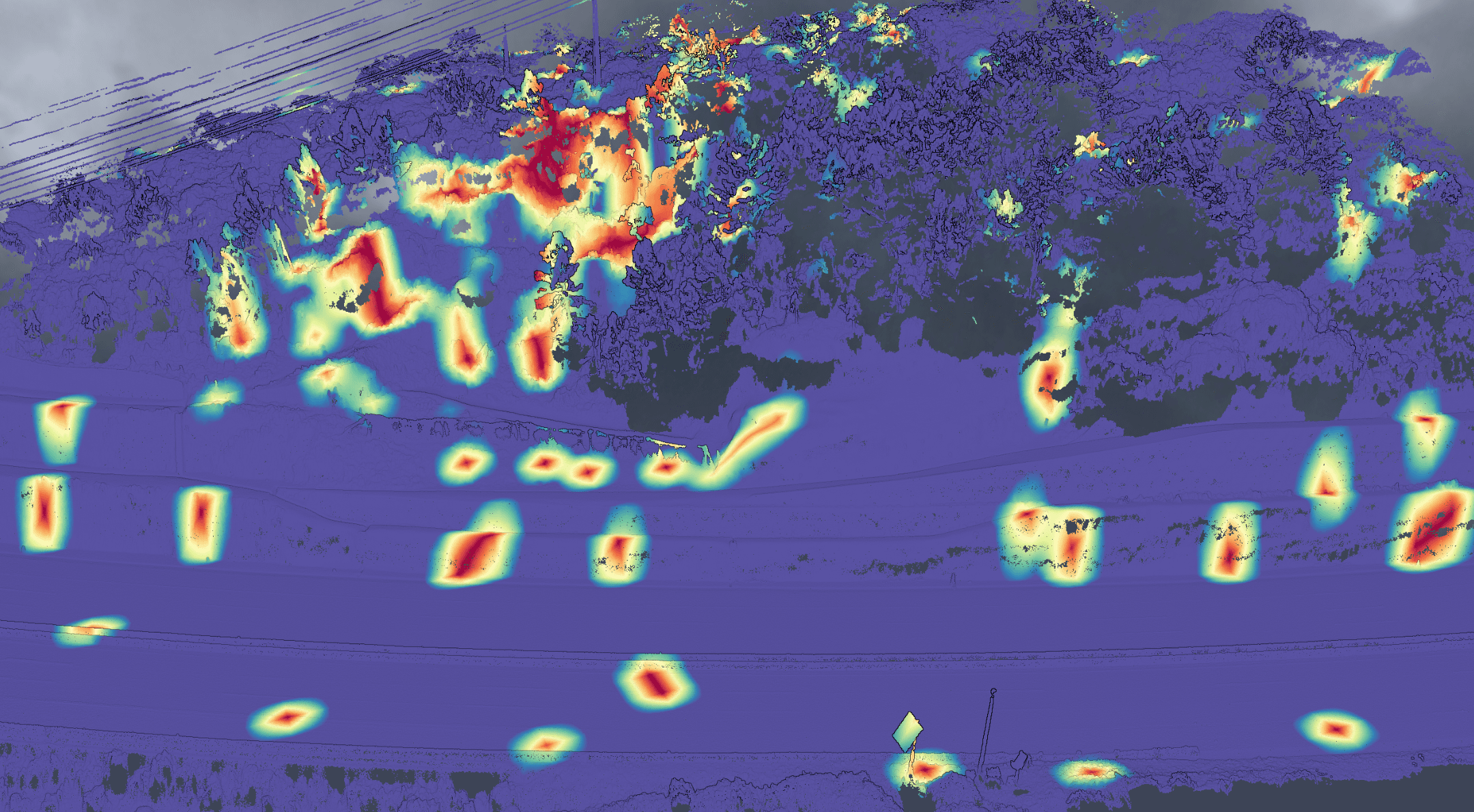
Based on the detailed characterisation and classification of the area under study, it is possible to identify areas and clusters of particularly high risk, allowing teams to focus and prioritise their work, generating high levels of efficiency.
On the other hand, by consolidating all the relevant information in an integrated way, the solution will provide a panoramic view of all the projects as well as the necessary insights for more informed decisions and better risk management of critical infrastructure.


Why RockVision.AI


The RockVision.AI solution allows a detailed three-dimensional reconstruction to be carried out quickly, accurately and at scale, thus obtaining a reliable representation of the real world.
The RockVision.AI solution allows a detailed three-dimensional reconstruction to be carried out quickly, accurately and at scale, thus obtaining a reliable representation of the real world.
The RockVision.AI solution allows a detailed three-dimensional reconstruction to be carried out quickly, accurately and at scale, thus obtaining a reliable representation of the real world.


Given the magnitude of the information generated, it ensures that access, visualisation and interaction with the system are fluid and easy.
Given the magnitude of the information generated, it ensures that access, visualisation and interaction with the system are fluid and easy.
Given the magnitude of the information generated, it ensures that access, visualisation and interaction with the system are fluid and easy.


RockVison.AI's geotechnical simulation will allow technical teams to simulate various scenarios and possible fall paths by varying different model parameters.
RockVison.AI's geotechnical simulation will allow technical teams to simulate various scenarios and possible fall paths by varying different model parameters.
RockVison.AI's geotechnical simulation will allow technical teams to simulate various scenarios and possible fall paths by varying different model parameters.


By identifying and signalling areas of higher risk, it allows teams to focus and prioritise their work, generating high levels of efficiency. All this in a fully automatic and integrated way.
By identifying and signalling areas of higher risk, it allows teams to focus and prioritise their work, generating high levels of efficiency.
All this in a fully automatic and integrated way.
By identifying and signalling areas of higher risk, it allows teams to focus and prioritise their work, generating high levels of efficiency. All this in a fully automatic and integrated way.


